Explore Terrain Engineering
Explore Terrain Engineering
The Discipline That Reads, Diagnoses, and Redesigns Landforms for Safety, Resilience, and National Advantage.
Terrain Engineering is a Philippine-born discipline that integrates DEM terrain intelligence, hydrology, geomorphology, climate interaction, and engineering judgment to systematically diagnose and redesign landforms. We transform vulnerable landscapes into resilient environments that protect communities, optimize infrastructure, and provide strategic national advantage.
Why Terrain Engineering Exists
Traditional engineering disciplines focus on structures, but the land itself remains undiagnosed and unengineered. Terrain failures cause billions in damage and countless lives lost annually, yet most are predictable and preventable.
Terrain Failures We Address:
- Landslides & Slope Failures
- Flash Floods & Basin Overflow
- Road Collapses & Infrastructure Failure
- Drought & Basin Death
- River Misalignment
- Aquifer Exhaustion
- Coastal Erosion
- Subsidence & Ground Instability
“Terrain Engineering addresses the root causes behind these failures.”
Why Terrain Engineering Exists
Traditional engineering disciplines focus on structures, but the land itself remains undiagnosed and unengineered. Terrain failures cause billions in damage and countless lives lost annually, yet most are predictable and preventable.
Recurring Landslides
Unstable slopes threaten communities and infrastructure
Flash Flooding
Poor drainage design leads to catastrophic urban flooding
Erosion & Sediment Loss
Uncontrolled erosion degrades land and clogs waterways
Subsidence
Ground collapse damages buildings and critical infrastructure
Unsafe Development
Construction on hazardous terrain without proper analysis
Ecological Degradation
Terrain alteration without environmental consideration
Infrastructure Vulnerability
Roads, bridges, and utilities exposed to terrain failure
Climate Intensification
Extreme weather events amplify terrain-based risks
The Five Pillars of Terrain Engineering
Our discipline is built on five interconnected pillars that form a comprehensive approach to understanding and transforming landscapes.
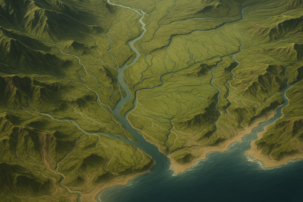
Pillar 1: Terrain Intelligence & Diagnostics
🔹Slope gradient & curvature analysis
🔹Surface roughness mapping
🔹Hydrology flow routing
🔹Ridge-valley network analysis
🔹Catchment delineation
🔹Landslide signature detection
🔹Sediment pathway modeling
🔹DEM-based terrain profiling
Pillar 2: Terrain Failure Analysis
🔹Landslide indicators & triggers
🔹Road cracking & subsidence patterns
🔹Basin dysfunction diagnosis
🔹Flood corridor mapping
🔹Erosion hotspot identification
🔹Slope instability signatures
🔹Infrastructure undermining risk
🔹Failure cascade modeling
Pillar 3: Terrain Advantage Redesign
🔹Road alignment optimization
🔹Drainage network redesign
🔹River corridor restoration
🔹Basin rehabilitation plans
🔹Irrigation system layout
🔹Slope stabilization engineering
🔹Urban expansion terrain prep
🔹Infrastructure suitability zoning
Pillar 4: Water & Basin Engineering
🔹Basin health scoring systems
🔹Micro-basin doctrine application
🔹Aquifer recharge zone design
🔹Drought reconstruction planning
🔹DEM watershed masterplanning
🔹Water cycle optimization
🔹Retention & detention systems
🔹Groundwater flow engineering
Pillar 5: Climate–Terrain Interaction Analysis
🔹Typhoon amplification mapping
🔹Storm surge vulnerability zones
🔹Heat island terrain factors
🔹Drought susceptibility analysis
🔹Sediment mobilization modeling
🔹Climate-terrain feedback loops
🔹Extreme weather response design
🔹Resilience scenario planning
Baguio-La Trinidad Connector Road
Benguet Province, Philippines
- Digital Elevation Models (DEMs) and LiDAR scanning
- Topographic map analysis and contour interpretation
- Slope gradient and aspect mapping
- Geological and soil composition assessment
- Identification of natural drainage patterns
- Recognition of terrain anomalies and instabilities
- Historical terrain change detection
- Multi-scale terrain classification
Outcome: Complete terrain intelligence that reveals vulnerabilities and opportunities for intervention
Pillar 2: Hydrological Diagnosis
Understanding water behavior is critical to terrain safety. This pillar focuses on analyzing how water interacts with landforms, from precipitation to runoff to infiltration.
- Watershed and sub-basin delineation
- Flow accumulation and direction modeling
- Flood zone identification and mapping
- Drainage network analysis
- Rainfall-runoff relationship studies
- Soil moisture and infiltration capacity
- Storm surge and coastal flooding assessment
- Groundwater flow and aquifer mapping
Outcome: Comprehensive hydrological intelligence that predicts flood risk and guides drainage design
Pillar 3: Terrain Redesign
Terrain Redesign translates analysis into action. This pillar encompasses the engineering interventions that physically modify land to reduce risk and enhance resilience.
- Cut-and-fill operations for slope stabilization
- Retention basin and detention pond design
- Drainage channel engineering and optimization
- Terracing and contour modification
- Retaining wall and structural support systems
- Erosion control and revegetation strategies
- Land grading and surface water management
- Underground drainage infrastructure
Outcome: Engineered terrain solutions that transform vulnerable landscapes into safe, functional environments
Pillar 4: Predictive Simulation
Before implementing solutions, we simulate terrain behavior under various conditions. This pillar uses computational models to forecast outcomes and validate designs.
- Hydraulic and hydrological modeling (HEC-RAS, SWMM)
- Slope stability analysis and factor of safety
- Erosion and sediment transport simulation
- Flood inundation mapping
- Climate scenario modeling (extreme rainfall)
- What-if analysis for design alternatives
- Failure mode and effects analysis
- Long-term terrain evolution prediction
Outcome: Evidence-based confidence in terrain interventions before construction begins
Pillar 5: Strategic Integration
Terrain Engineering must align with broader national goals. This pillar ensures that terrain intelligence informs policy, planning, and strategic decision-making.
- Integration with national infrastructure plans
- Climate adaptation and disaster risk reduction
- Land use policy and zoning recommendations
- Defense and security terrain intelligence
- Retaining wall and structural support systems
- Agricultural land optimization
- Environmental conservation strategies
- International terrain engineering standards
Outcome: Terrain intelligence that shapes national resilience and competitive advantage
Methods & Tools
Terrain Engineering leverages cutting-edge technologies and proven methodologies to deliver precise, actionable results.
Geospatial Foundations
- DEM analysis & processing
- 2.5D & 3D terrain intelligence boards
- Hypsometry & Swiss mapping
- Flow routing & hydrology modeling
- LiDAR point cloud analysis
- Satellite imagery interpretation
- Multi-scale terrain classification
Engineering Integration
- Road alignment redesign
- Infrastructure suitability mapping
- Foundation stability assessment
- Slope & retaining wall logic
- Cut-and-fill optimization
- Drainage network engineering
- Geotechnical integration
Simulation & Decision Systems
- Terrain Advantage planning
- Flood & landslide scenarios
- Micro-basin simulations
- Commander-level geospatial strategy
- Climate impact modeling
- Risk-based decision frameworks
- What-if analysis tools
Applications of Terrain Engineering
From urban planning to national defense, Terrain Engineering provides solutions across diverse sectors and scales.
Infrastructure Engineering
Route planning and terrain analysis for infrastructure that survives climate extremes.
Mountain Road Construction
Cut/fill optimization and mass-movement prediction for roads that stop collapsing.
Basin & Watershed Design
Comprehensive watershed management, micro-basin doctrine, and water cycle engineering
Environmental Management
Erosion control, riparian restoration, and ecosystem-based terrain solutions
Agriculture & Irrigation Engineering
Pit slope stability and waste dump siting for safer mining operations
Urban & Regional Planning
Agriculture & Irrigation Engineering Irrigation routing and crop zoning for higher yields with less water loss.
Mining & Resource Engineering
Disaster Risk Reduction & National Safety Landslide prediction and terrain-based early warning systems.
Disaster Risk Reduction & National Safety
Landslide prediction and terrain-based early warning systems.
Water Infrastructure & Hydrology
Dam suitability and reservoir catchment analysis for sustainable water systems.
Energy & Power Infrastructure
Power line routing and renewable energy site optimization.
Coastal & Marine Engineering
Military & National Defense Mobility corridors, concealment analysis, and tactical terrain advantage.
Military & National Defense
Mobility corridors, concealment analysis, and tactical terrain advantage.
Scientific Research & Geospatial Intelligence
Geomorphology studies and landscape evolution analysis.
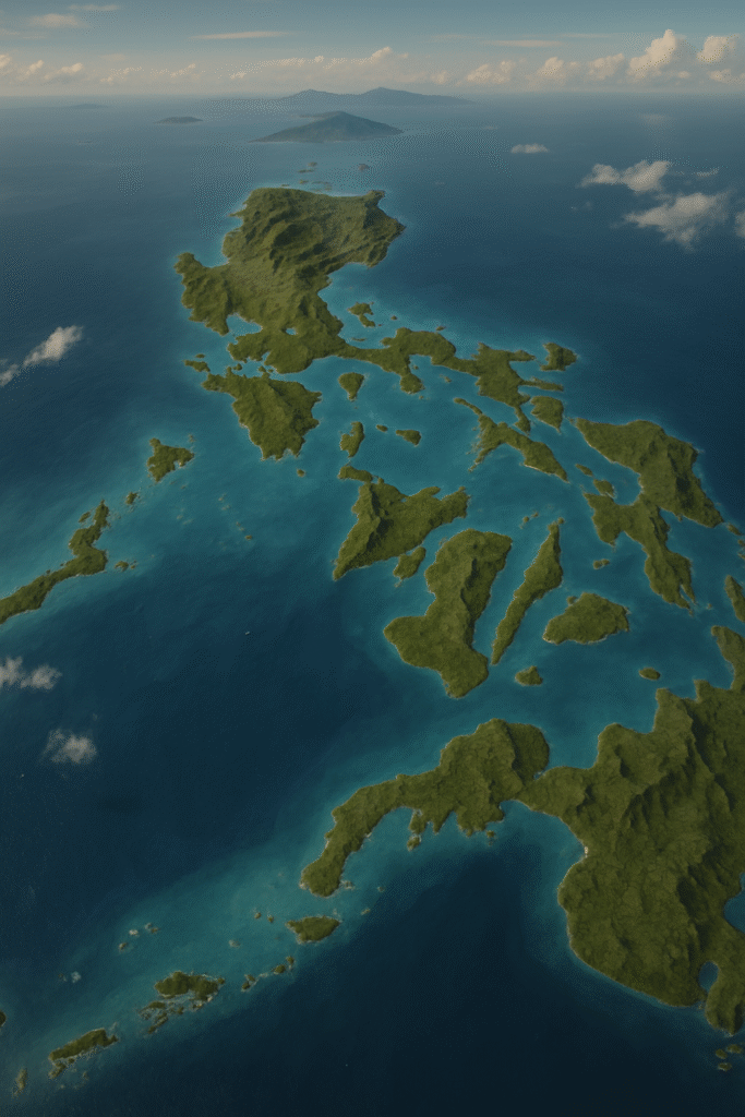
Philippine Origin Story
The Philippines faces a perfect storm of terrain challenges: an archipelago of 7,641 islands with steep mountainous terrain, intense monsoons, and 20+ annual typhoons. Traditional engineering approaches were insufficient to address the complex interaction between climate and landforms.
National Terrain Challenges:
- Frequent typhoon routes
- Steep complex terrain
- Persistent landslides
- Basin death
- Aquifer exhaustion
- Coastline erosion
- Climate extremes
- Subsidence & Ground Instability
“The Philippines became the natural birthplace of Terrain Engineering.”
Key Aspects of Terrain Engineering
A systematic approach to understanding and transforming landscapes through analysis, data collection, and specialized tools.
Terrain Analysis
- Slope gradient & aspect mapping
- Drainage pattern identification
- Landform classification
- Geological hazard assessment
- Soil composition analysis
- Vegetation cover evaluation
- Ridge-valley network analysis
- Terrain morphology profiling
Data Collection
- LiDAR elevation scanning
- Satellite multispectral imagery
- Ground survey and GPS
- Rainfall and climate records
- Historical disaster data
- Soil and rock sampling
- Hydrological measurements
- Field reconnaissance
Tools & Software
- QGIS - Open-source GIS platform
- GRASS GIS - Terrain analysis suite
- SAGA GIS - Geoscience algorithms
- LiDAR processing tools
- Digital Elevation Models (DEMs)
- HEC-RAS - Hydraulic modeling
- SWMM - Stormwater simulation
- Civil 3D - Engineering design
What Terrain Engineering Delivers
Actionable outputs that guide decision-making, construction, and policy at every scale.
Terrain Diagnosis Reports
Comprehensive assessment of landforms, vulnerabilities, and terrain intelligence
Terrain Intelligence Boards
2.5D and 3D visualization systems for decision-makers and commanders
Redesign Plans
Engineering drawings and specifications for terrain modification projects
Road Correction Maps
Alignment optimization and cut-fill balancing for safer mountain roads
Basin Rehabilitation Plans
Watershed restoration strategies and micro-basin engineering solutions
Flashflood & Landslide Analysis
Hazard mapping, risk quantification, and mitigation recommendations
National Water Cycle Reconstruction
Country-scale hydrological planning and aquifer recharge strategies
Terrain Advantage Masterplans
Strategic frameworks for national infrastructure and defense positioning
World's First Structured Terrain-Based Discipline
Core Purpose & Global Vision
Terrain Engineering stands as the world’s first structured terrain-based discipline. To establish a recognized engineering frontier that diagnoses, predicts, and redesigns landforms—preventing disasters, protecting communities, and creating strategic terrain advantage.
Insight
See what others miss—terrain vulnerabilities hidden in the landscape
Prevention
Stop disasters before they happen through proactive terrain intervention
Redesign
Transform risky landforms into safe, resilient environments
Simulation
Predict terrain behavior and validate solutions before construction
Strategy
Align terrain intelligence with national goals and competitive advantage
From the Philippines to the world, Terrain Engineering represents a paradigm shift in how we understand and interact with land—making terrain intelligence a cornerstone of national resilience and development.
Global Vision
Terrain Engineering PH: A New Global Engineering Frontier
Our mission is to establish this discipline globally, with the Philippines as its origin— exporting expertise, methodology, and innovation to transform how nations approach terrain challenges.
2024 Philippine Foundation Year
Philippine Foundation Year
Establishing core methodology and national pilots
2025–2027
Regional Expansion
ASEAN partnerships and international recognition
2030
Global Standard
Recognized engineering discipline worldwide
Terrain Engineering is not just a service—it’s a movement to redefine how humanity interacts with land. From preventing disasters to enabling sustainable development, this discipline will shape the future of engineering.
Join us in building the future of terrain resilience.