OUR WORK
Exploring how GeoComms transforms spatial data, imagery, and field observations into actionable information.
Corn Multispectral Analysis
Spectral Assessment of Maize Crop Health, Vigor, and Variability
Analyze corn/maize crop conditions using multispectral imagery and dedicated vegetation-index layers. The analysis evaluates spatial variations in maize canopy vigor, chlorophyll activity, vegetation density, and crop stress patterns throughout the field to support field-level crop assessment and precision agriculture.
NDVI
Normalized Difference Vegetation Index
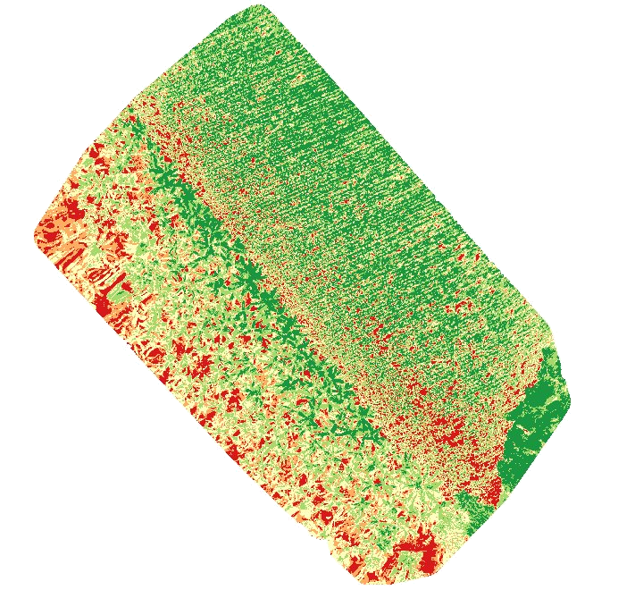
A multispectral analysis of the banana plantation, using NDVI to identify spatial variation in canopy response and areas for field inspection.
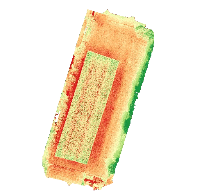
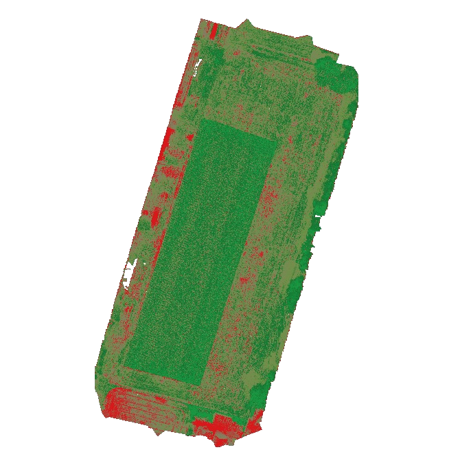
CORN NDVI CROP HEALTH ASSESSMENT
NDVI Screening — Corn Field
Detailed NDVI analysis of the corn field, covering overall vegetation condition, value distribution, spatial variability, canopy vigor, and areas requiring further field attention.
NDRE
Normalized Difference Red Edge Index
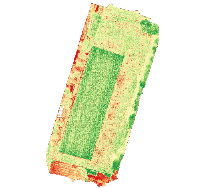
NDRE provides a complementary vegetation-index layer using red-edge information from the multispectral dataset
CHLOROPHYLL RESPONSE ANALYSIS
NDRE Screening — Corn Field
Detailed NDRE analysis examining Red Edge vegetation response, spatial variability, and areas with relatively reduced or elevated spectral response across the corn field.
OSAVI
Optimized Soil-Adjusted Vegetation Index
OSAVI provides another perspective on vegetation response while reducing the influence of exposed soil in the index calculation.
SOIL-ADJUSTED VEGETATION ANALYSIS
OSAVI Screening — Corn Field
Detailed OSAVI analysis examining soil-adjusted vegetation response, spatial variability, and areas of relatively strong or reduced vegetation response across the corn field.
Banana Multispectral Analysis
Spectral Assessment of Banana Crop Health, Vigor, and Variability
Analyze banana crop conditions using multispectral imagery and dedicated vegetation-index layers. The analysis evaluates spatial variations in banana canopy vigor, chlorophyll activity, vegetation density, canopy development, and crop stress patterns throughout the plantation to support field-level crop assessment and precision agriculture.
NDVI
Normalized Difference Vegetation Index
A multispectral analysis of the banana plantation, using NDVI to identify spatial variation in canopy response and areas for field inspection.
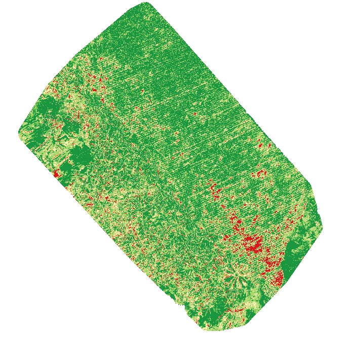
NDVI Field-Inspection Priority Assessment
Remote-Sensing NDVI Screening — Banana Plantation Canopy
Automated NDVI screening of a banana plantation canopy, identifying spatially depressed NDVI areas and organizing them into field-inspection priority areas.
NDRE
Normalized Difference Red Edge Index
NDRE provides a complementary vegetation-index layer using red-edge information from the multispectral dataset.
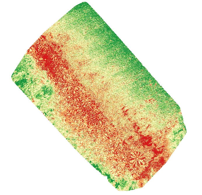
CANOPY CHLOROPHYLL & MATURITY ASSESSMENT
NDRE Screening — Banana Plantation Canopy
Detailed NDRE analysis examining Red Edge response, canopy development, spatial variability, and areas of relatively stronger or reduced spectral response across the banana plantation.
OSAVI
Optimized Soil-Adjusted Vegetation Index
OSAVI provides another perspective on vegetation response while reducing the influence of exposed soil in the index calculation.
CANOPY–SOIL BACKGROUND ANALYSIS
OSAVI Screening — Banana Plantation Canopy
Detailed OSAVI analysis examining soil-adjusted vegetation response, spatial variability, canopy coverage, and areas of stronger or reduced spectral response across the banana field.