GeoComms

Data Collector

Connect your field team. Map your findings. Build a reliable record.

Know what is happening across your farms, facilities and project sites. Record locations, photographs and observations in the field, then bring those findings into organized maps and records for office review..
Fieldwork

From Fieldwork to Organized Spatial Records

Turn field observations into structured, location-based information that your office team can review, update and use for decision-making.

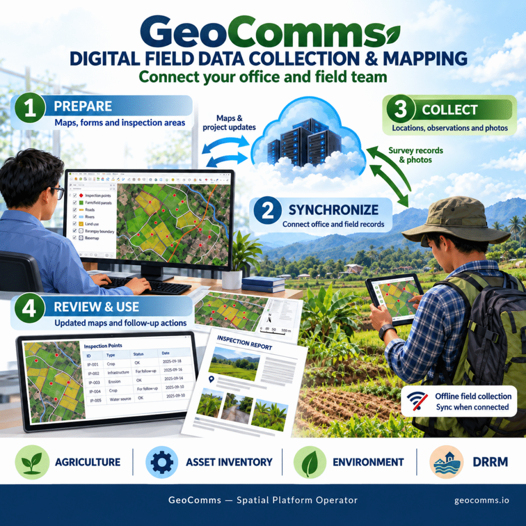
01 — PREPARE

Prepare Your Project

We configure your maps, digital forms, identification codes and inspection areas around the information you need to collect.

02 — COLLECT

Collect in the Field

A stable, survey-grade antenna and fixed reference station provide a consistent local positioning source.

03 — CONNECT

Connect Field and Office

When connectivity is available, field teams synchronize their work to upload new findings and receive updated maps, forms and project information.

04 — REVIEW

Review & Follow Up

Office teams review submissions, identify locations requiring attention and plan subsequent visits.

Each visit can contribute to a continuing history for a tree, asset, facility or site.

Applications

Built for Real Field Operations

Farms & Plantations

Tree inventories, crop inspections, planting survival, farm observations and harvest records.

Businesses & Utilities

Asset registration, condition surveys, maintenance inspections and work verification.

Government & Infrastructure

Roads, drainage systems, public facilities, infrastructure inventories and field inspections.

Forestry & Environment

Tree geotagging, restoration monitoring, sampling sites and repeat environmental observations.

Public Health & Research

Location-linked questionnaires, environmental observations and field studies.

Disaster Management

Hazard observations, evacuation facilities, damage assessments and rapid field reporting.

Spatial Records

Give every recorded item a unique identity.

A return visit adds to the item’s history, helping your team understand what changed, what was observed and what needs attention.
 

Photographs

Condition assessments

Activities

Inspection records

Dated observations

Follow-up visits

Technology

Powered by QGIS, QField & GeoComms-Hosted QFieldCloud

qfield.geocomms.io

The platform connects office mapping and mobile fieldwork through infrastructure administered by GeoComms.

QGIS

QGIS

Prepare maps, configure survey forms, review field records and perform spatial analysis.

QFIELD

QField

Collect and update mapped observations, photographs and attributes using phones and tablets.

QFIELDCLOUD

QFieldCloud

Synchronize projects, maps and field updates between office and mobile teams.

POSITIONING

External GNSS / RTK

Support higher-accuracy positioning where required using compatible GNSS/RTK equipment and available correction services.


Workflow

A Complete Field Data Workflow

PLAN

COLLECT

SYNC

REVIEW

FOLLOW UP

GeoComms configures and supports the workflow from project preparation through field collection, synchronization and office review.

You get a field system designed around your data, your locations and your workflow.

GeoComms Services

What GeoComms Provides

Project & Map Setup

Prepare project maps, layers, inspection areas and spatial data.

Customized Digital Forms

Configure forms and fields around the information your team needs to collect.

Hosted Synchronization

Connect mobile field teams with your office through GeoComms-hosted QFieldCloud.

User & Project Administration

Manage project access, field teams and operational requirements.

Field-Team Training

Help your team understand the mobile collection workflow and field procedures.

Data Preparation & Backups

Prepare project data and support reliable records and operational continuity.

Ongoing Support

Technical and workflow support from project setup through field operations.

Scroll to Top